As a part of the 2023 Water Quality Monitoring season, JRA staff members shared a little about a few of their favorite river access points. Each year between Memorial Day and Labor Day volunteers take water quality samples and post them to our James River Watch website.
River conditions are posted every Friday from Memorial Day to Labor Day. Sign up to receive a notification email when the results are in!
Chickahominy Riverfront Park
 Chickahominy Riverfront Park is a James City County Park that offers bike and hiking trails, camping, kayaking, and fishing, just off of Route 5 and along the Capital Trail.
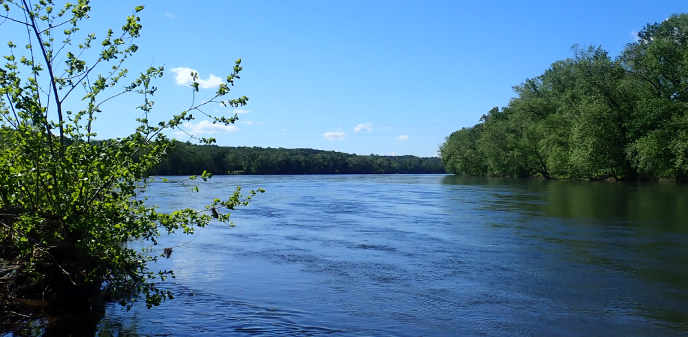
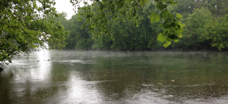
Paddling from Chickahominy Riverfront Park lets you choose your own adventure! If you launch from the boat ramp, it is just a short trip to where the Chickahominy flows into the James River. Here the James is expansive; you can see miles across the water to the wild and natural shorelines of Surry County. If you’d prefer an experience in more sheltered waters, you can explore the Chickahominy River itself. My personal favorite area to explore by kayak is Gordon Creek, which is a peaceful, winding path through vibrant freshwater tidal wetlands. I first discovered Gordon Creek as a rower at William and Mary, as the college and community rowing programs are based at the park. These days, I prefer to explore the creek at a slower pace; if you sit in the wetlands long enough you are bound to see the area teeming with wildlife.
College Creek Beach
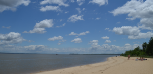 College Creek Beach is located along the scenic Colonial National Historical Parkway in Williamsburg. The beach is located where College Creek feeds into the James River. The closest parking is across the parkway and patrons can cross over to access the beach which is just a short walk.
This station is a great place to have a beach day without heading all the way down to the coast. Sunbathing and picnicking are great ways to spend your day at this station. I spent my day here people-watching, dog-watching, and enjoying the breeze. However, this site has a very strong rip current so swimming is prohibited at this site.
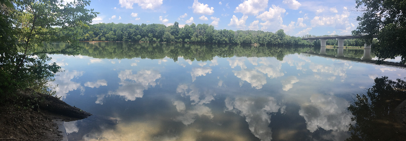
Grapevine Bridge Public Access
 Grapevine Bridge Public Access is located along the Chickahominy River in Henrico County and is accessible via a large gravel parking area along Route 156 (N. Airport Drive). The site accommodates the launching of paddlecraft and is a popular spot for fishing.
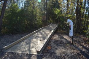
Grapevine Bridge Public Access opened to the public in November 2014 and provides low-impact fishing and paddling access to the Chickahominy River in eastern Henrico County. The effort to enhance the site began in early 2014 when a concept plan was developed by the James River Association and volunteer events were organized to beautify and improve the site for public enjoyment. The site features a trail and boardwalk, canoe launch, benches, and interpretive signage for the Chickahominy Water Trail, a segment of the Captain John Smith Chesapeake National Historic Trail. The project is a collaboration between the James River Association, Virginia Department of Transportation, Henrico County, and National Park Service.
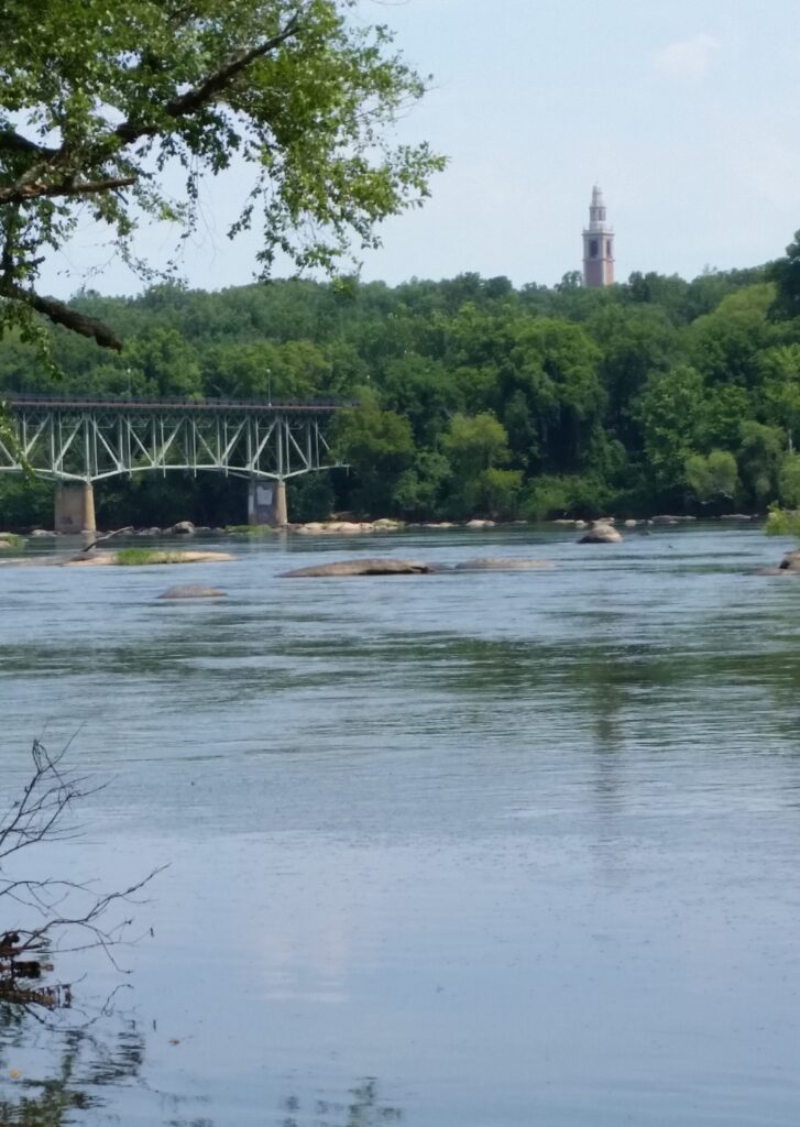
Riveredge Park
 Riveredge Park is located at 150 Rocky Hill Road in Madison Heights, just across the James River from Historic Downtown Lynchburg. It is also home to our James River Adventures program and our Upper James River Education Center. We offer batteau trips every Tuesday and kayak paddles every Friday at this location.
This access point has a large concrete ramp, perfect for boating or kayaking. The parking lot is large at the park, but there will be construction at the park this summer so be aware of potential parking issues. Traveling downstream, there are some small rapids but the area is mostly flatwater and fairly easy to paddle. The area directly around the park is an easy out-and-back paddle, but be aware of the dam upstream.
Not interested in paddling? There is also an updated playground area for kids and a half mile asphalt trail perfect for walking or biking. There are also benches for enjoying the beautiful view and areas for an afternoon picnic!
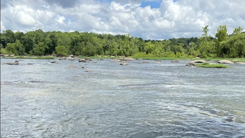
Scottsville Public Boat Ramp
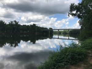 The Scottsville Public Boat Ramp is located just across the railroad tracks from James River Reeling & Rafting on Ferry Street in the town of Scottsville. This gravel parking lot has two boat ramps available for use. The boat ramps are located at the top of a horseshoe-shaped bend in the river, just downstream from the Route 20 bridge. Downstream you can find the Seven Islands section of the river, while upstream there are some class I and II rapids. The section of river near Scottsville also happens to be the site of a recent reintroduction of the James spinymussel, an endangered species native to the James River.
42nd Street
 The 42nd Street RiverWatch sampling site is a nice shady spot to take in the view while you catch your breath from hiking or biking the trail and a great place to have a family picnic using the shelter and tables. Just a short walk west on the gravel path from the stairs of the 42nd St parking lot in the James River Park System and the view of the James really opens up.
You will see the Nickel Bridge upstream, the red River’s Edge Building to your east, and can probably glimpse folks enjoying Texas beach across the water. It’s common to see bird watchers, runners, hikers, bikers, dog walkers, and even more people headed by this spot, but it tends to be a little sleepier than the broad bedrocks of 42nd St Island. At this location, you’ll see a shelter, two picnic tables, wood-braced steps for a put-in onto the water, and several short river’s edge trails curling off up and downstream.
Huguenot Flatwater
 Huguenot Flatwater is a one-stop shop for river fun in Richmond. As noted by Friends of the James River Park, river lovers can paddle, tube, swim, fish, hike, and view all kinds of wildlife at this site, which includes a universal access boat ramp. A perfect spot for launching a kayak or stand up paddle board, this site provides an easy and beautiful flatwater adventure (though river users should take care to observe the dangers of Bosher Dam upstream and Z Dam downstream from the site).
Huguenot Flatwater is the western-most outpost of the James River Park System, located at 8600 Riverside Drive just west of the Huguenot Memorial Bridge. The parking lot fills up quickly on a sunny summer day, so it’s advisable to get to the park early if you want a spot!
Learn more about the importance of river accessibility through this story shared by Sally Wetzler, an avid kayaker and long-time member of the James River Outdoor Coalition.
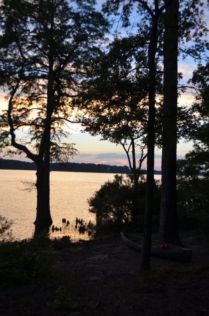
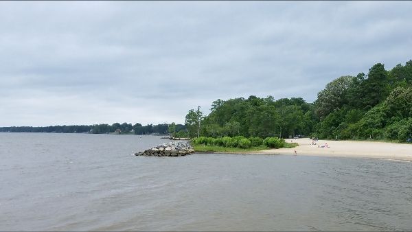
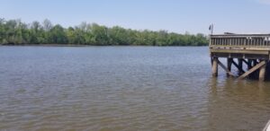
Old City Point Waterfront Park
 Old City Point Waterfront Park, located right where the James River meets the Appomattox River, is the perfect place to fish, kayak, canoe, spend an afternoon outdoors, or watch the sunset. This beautiful park is equipped with a fishing pier, ample parking, walking paths, bathrooms, and lots of areas to picnic.
City Point is also home to many historical museums and sites due to its importance during the civil war. The headquarters of Ulysses S. Grant during the Siege of Petersburg is less than a quarter of a mile away from the James River Watch testing site. If you are interested in a day of taking in history and nature, City Point is a great contender.
Jamestown Beach
 Jamestown Beach is located in Williamsburg, Virginia, and is a family (and dog) friendly beach public park! The park is open daily from 8 am until sunset and has picnic areas with charcoal grills; a designated fishing area (freshwater license is required); an observation pier (for viewing only); outdoor rinse stations; paddle craft launch/loading/storage area; and a concession facility where ice cream, hot dogs, burgers, drinks and snacks are sold. There is also an ADA-accessible walkway, parking, restrooms, and a beach mat that provides direct access to the river
There is no fee to enter the park, but residents outside of James City County and the City of Williamsburg are required to pay parking fees which are charged 8 a.m. – 5 p.m. on weekdays, and 8 a.m. – 6 p.m. on weekends and holidays from Memorial Day Weekend through Labor Day.
And if you are looking for a unique event, the 2023 Cal Tri Williamsburg is this Sunday! You can still register, or just go to cheer on a friend!
Pony Pasture
 Pony Pasture is one of the most popular locations within the James River Park system in Richmond. There are plenty of opportunities to enjoy the river. You can easily put in a canoe or kayak to brave the class II rapids here, get out your fishing pole and catch a few fish, enjoy a walk along the river, or take a dip.
During late summer to early fall, this is a great place to forage for pawpaws, a delicious fruit that can be found growing on Pawpaw trees near the river! One of my favorite activities is walking along the beautiful shaded paths around Pony Pasture and giving the Pawpaw trees a little shake to see if any fruit comes loose. If I am lucky enough to get a good haul, I love to enjoy the lovely, custardy treat while lounging by the river after a long hike.
Reedy Creek
 Reedy Creek is home to one of our James River Watch testing sites as well as the James River Park System Headquarters! This site is easily accessible from Riverside Drive, with a few different parking options available. These options include the 42nd Street entrance, along Riverside Drive near the headquarters, or in the 22nd Street parking lot if you are interested in a longer walk. There are also bathrooms, a Port-a-Potty, and a changing room if you want to change into some dry clothes after a fun day swimming or paddling the river.
Reedy Creek has a great launch spot, so it is the perfect place to start and/or end your day of paddling! There are a few picnic tables located around the park, great for a snack after you work up an appetite swimming in, walking along, or paddling the river. Within the Reedy Creek area, there is another trail called the “Buttermilk Trail.” This trail got its name years ago, when milk was still directly delivered to households, because it holds a cool well where milk would be stored to keep it cold. If you are looking for a place to spend your day enjoying a nice hike or mountain bike ride, Reedy Creek is a wonderful option!
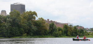
Rocketts Landing
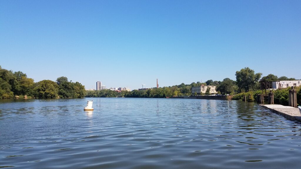 Rocketts Landing currently houses Richmond’s only marina, which is where water is sampled for testing at this site. Rocketts Landing is also home to a few tasty restaurants including The Boathouse, Island Shrimp Co., and Besos Mexican Cantina.
This testing site is located right on the Virginia Capital Trail, a paved pedestrian and bicycle trail that spans over 50 miles from Richmond to Williamsburg. This is one of my favorite places to go for a long stroll and take in beautiful views of Richmond’s city skyline. This area of the trail is often bustling with joggers, bicyclists, and people enjoying the local restaurant patios. There is also a small bicycle rental shop run out of a shipping container called “The Kickstand,” which presents the perfect opportunity to enjoy a ride on Capital Trail if you don’t already own a bike.
Our previous JRA office was located right in the heart of Rocketts Landing. One of my favorite things to do during a break was to grab ice cream from the small market around the corner from the office, then take a short walk down the riverside trail. There was often laughter and excitement coming from people playing on the sand volleyball courts right past The Boathouse, yet the area still remained very tranquil. Spending just a few minutes outside taking in the view of the James was always the perfect reset to refresh my mind and get back to work protecting our river!
Osborne Landing
 One of my favorite places to kayak near Richmond is Osborne Landing. This site has lots of parking, three full-size boat ramps, bathrooms, and a fishing pier. It’s also home to The Lilly Pad, one of the few restaurants in the Richmond area where you can eat on the river.
During August and September, this site is a great place to put in for Sturgeon Watching. If you turn right and head upstream you can see the Jimmy Dean logo on the bank of one of the houses lining the river. If you head downstream, you will pass the Chesterfield Power Plant and then can reach Henricus Park and Dutch Gap Conservation Area.
During one of my first trips with the James River Association, we set out from Osborne Landing about an hour before sunset. We were out paddling and looking for sturgeon, but I kept getting distracted by the geology of the cliff banks. The white and tan stripes you can see are sedimentary rock layers, formed by sand, clay, and gravel deposits over time. I had started to fall behind the rest of the group in my distracted state, and I could see them starting to turn around to head back to the boat ramp. Just before I started to turn around too, a large fish jumped out of the water between me and the rest of the group making a big splash! I caught the tail end of a few more splashes on our paddle back, but that was the only sturgeon I managed to spot that day.
Deep Bottom Park
 Deep Bottom Park is a serene place to paddle, boat, fish, and birdwatch! It is located on a quiet meander of the tidal James River, and is a perfect place to spot osprey, bald eagles, great blue herons, and during the spring and summer, prothonotary warblers! The park has bathrooms and picnic pavilions, and is home to a boat launch and dock on the James River, as well as a canoe launch on a small tributary, Four Mile Creek. If you take some time to paddle up Four Mile Creek, you will come upon a lovely wetland area that is home to red wing blackbirds, fiddler crabs, tidal plants, and a host of other species. Across the creek from the wetlands is a large and active bald eagle’s nest!
On any given weekday, you might find me leading JRA leading paddle trips here with students from the surrounding area…it’s an ideal place for an immersive nature experience, both for students and adults alike!