
 One of my favorite ways to spend weekends during the summer is on the water. When you’re making your weekend plans, make sure to check river conditions at the James River Watch website to see if it’s safe to swim or boat. On the website we’ve gathered together weather, stream height and speed, temperature, and bacteria data in one place to make it easier to know before you go!
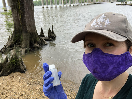
Since 2013 the James River Association has monitored water quality at popular river locations on the James River and its tributaries. We started late this year because of COVID, but from June 11th to Labor Day, trained volunteers collect water samples at sites frequented by the public for boating and swimming. Our program has expanded from 10 sites in 2013 to 31 sites in 2020 with the help of partners at American Water, Rivanna Conservation Alliance, Peninsula Master Naturalists, Henricopolis Soil and water Conservation District, Appomattox River Company, Riverside Outfitters and Twin River Outfitters.
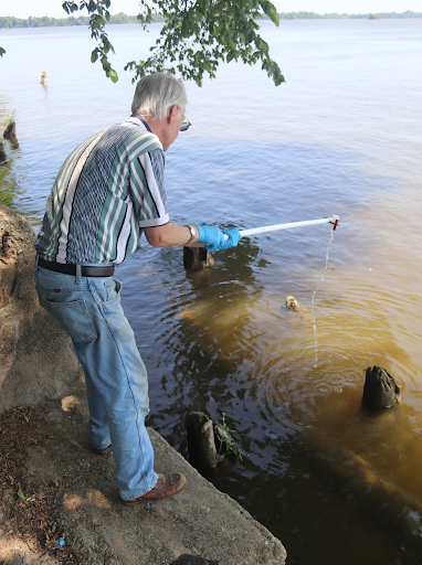 But what does it mean for the river to be safe? One thing to consider is the amount of harmful bacteria in the water. In the James River, we most often see high bacteria concentrations after rainstorms. Rain causes pollution from urban and agricultural sources to wash into the river. We might also see spikes if there are sewer leaks, or if there are large numbers of animals like geese or cows in the river. As part of James River Watch, we send out our awesome volunteers to test bacteria levels at local swimming spots and post the results every Friday during the summer. But you should still check the weather to see if it rained recently, just in case conditions might have changed since the sample was taken.
Severe rainstorms and flood events can also cause strong currents, high water levels, and debris that may make it unsafe to boat, paddle or swim. You can find information about water levels and stream flow on the River Watch website by clicking on one of the boating conditions stations.
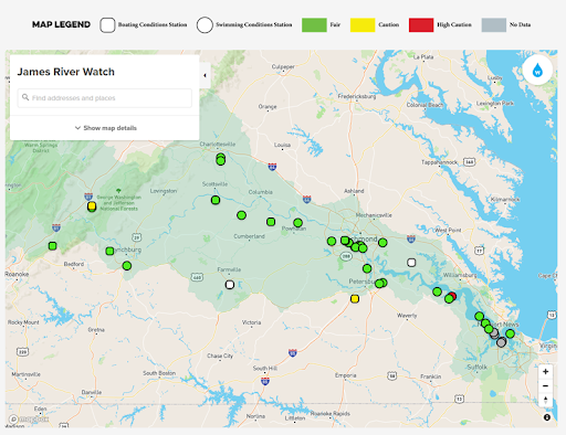 Weather conditions are especially important for river safety — that’s why we added the National Weather Service Weather Watches and Warnings to the River Watch map (you’ll have to turn this layer on to see them). Our volunteers also collect air and water temperature data. This might not be as important in the middle of July, but in the spring and fall there can be a risk of hypothermia. BoatUS recommends taking extra precautions when the combined air and water temperature in degrees Fahrenheit is less than 100. I was surprised to learn that your breathing can be affected if the water temperature is less than 77 degrees F.
There’s a lot to think about when you decide to spend time on the water, but we hope that by bringing all of this information into one place, you can be prepared for the river conditions and know before you go!